12 Arizona Hikes for 12 Months


Arizona is a hiker’s state. From snow-covered peaks in the White Mountains to red rock canyons in the desert, the trails here offer something different every month. Some are best when the air is crisp and the crowds are gone. Others shine when wildflowers bloom or creeks run cold and clear. Timing matters more than most people think. This guide picks one solid hike for each month, based on conditions, scenery, and when the experience is at its best.
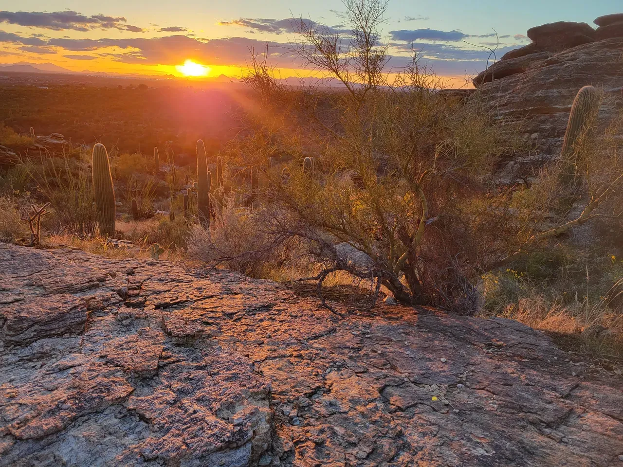
January: Black Cross Butte
Black Cross Butte is located in the Tonto National Forest, near the Salt River Canyon and northeast of Tortilla Flat, Arizona. This hike offers a challenging adventure with rewarding views of the surrounding desert landscape. The trail is approximately 2.6 miles round trip with an elevation gain of about 761 feet. It's considered moderately challenging due to its steep and rocky terrain. The route is unmarked and requires good route-finding skills, so it's recommended for experienced hikers. Be prepared with plenty of water, sturdy footwear, and a reliable map or GPS device.
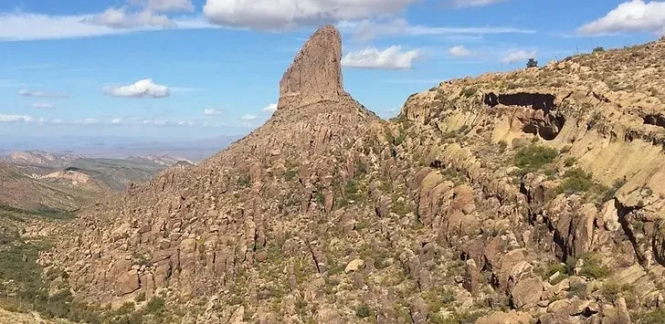
February: Fremont Saddle via Peralta Canyon Trail
This is one of the most popular hikes in the Superstition Mountains for a reason. The Peralta Canyon Trail climbs gradually through a rugged desert canyon filled with saguaros, volcanic rock, and open views. The trail ends at Fremont Saddle, where you get a perfect view of Weavers Needle rising from the landscape like a monument. February is one of the best times to hike it. The air is cool and the skies are clear. It is a steady uphill climb, but well-maintained and easy to follow. Out and back, it covers about five miles with roughly 1,300 feet of elevation gain.
March: Picacho Peak State Park
This is one of the most recognizable peaks in southern Arizona right between Phoenix and Tucson. The hike to the top is short in distance but intense. You’ll use steel cables bolted into the rock to scramble up steep sections, especially near the summit. Gloves are recommended. March is the ideal time to go because the temperature is still manageable and wildflowers often blanket the desert floor below. The views stretch across the Sonoran Desert, and on a clear day, you can see all the way to the Catalinas near Tucson. The full hike via the Hunter Trail is about two miles each way with 2,000 feet of elevation gain.
April: Fossil Creek Falls
Fossil Creek is one of the few designated Wild and Scenic Rivers in Arizona, fed by a natural spring that pumps out over 20,000 gallons per minute. The hike to the falls follows a dirt road from the trailhead near the old Irving Power Plant. The trail is about four miles round trip with minimal elevation change. The payoff is clear turquoise water, lush greenery, and a 25-foot waterfall with a pool deep enough for swimming. April is ideal since the weather is warm but not hot, and the creek is still flowing strong from winter. Permits are required this time of year and often sell out, so plan ahead. Bring plenty of water and sun cover.
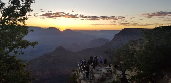
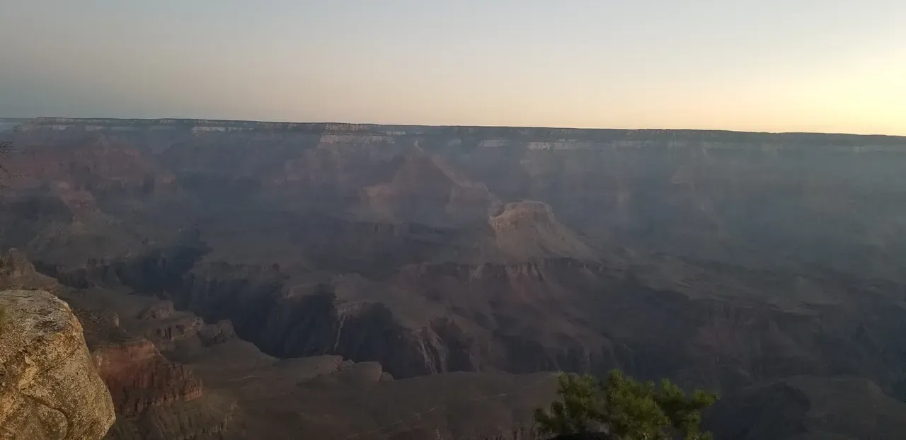
May: Grand Canyon Rim Trail
May is one of the best months to visit the Grand Canyon before the summer crowds and heat set in. The Rim Trail runs along the South Rim from Hermit’s Rest to the South Kaibab trailhead, offering some of the most iconic views in the entire park. The full route is about thirteen miles one way. The trail is mostly flat and well-maintained, with dozens of viewpoints along the way. This is the perfect option if you want big scenery without a steep descent into the canyon. Pack water, take your time, and stay on the rim where the breeze keeps things cooler.
June: Government Spring 95A
This trail offers a quiet escape into the pines just below the Mogollon Rim. Located in the Apache-Sitgreaves National Forest, Government Springs 95A runs through cool forest with sections of meadow, creek crossings, and shaded canyon walls. The trail stretches just over six miles one way, but many hikers turn around at the halfway point near the spring. June is a great time to be on this trail. The elevation keeps temperatures down, and the creek still flows in most years. Expect solitude, bird calls, and big trees overhead. Bring plenty of water and watch for elk tracks along the way.
July: Thompson Trail #629
This is one of the best summer hikes in Arizona. Located in the White Mountains near the town of Greer, Thompson Trail follows the West Fork of the Black River through cool pine forest and open meadows. The trail is just over five miles round trip and mostly flat, making it ideal for a relaxed walk with plenty of shade and water nearby. In July, the area is green, the river runs clear, and afternoon clouds often roll in to cool things down. Keep an eye out for deer, elk, and wild turkeys as wildlife sightings are common. It’s a peaceful spot to escape the summer heat without needing to push your limits.
August: Inner Basin Trail
When the desert is boiling, this trail offers one of the best escapes in Arizona. The Inner Basin Trail, near Flagstaff, starts in Lockett Meadow and climbs through a thick forest of aspen and fir. The air is cooler, the ground is soft, and the scenery feels more like Colorado than Arizona. August is ideal because wildflowers are still blooming, and you can hike all morning without overheating. The full route is about 3.5 miles out and back.
September: Water Wheels Falls
This trail follows the East Verde River just outside of Payson and leads to a series of small cascades and clear swimming holes. The hike is short at about 1.6 miles round trip and includes some rock hopping and stream crossings. September is one of the best times to visit. The summer crowds have thinned out, the water is still flowing, and the temperatures are much more comfortable. The highlight is the main waterfall at the end, where you can cool off in a natural pool surrounded by granite rock. This is a good pick for families or anyone looking for a quick hike with a big reward. Always check for flash flood warnings before heading out.
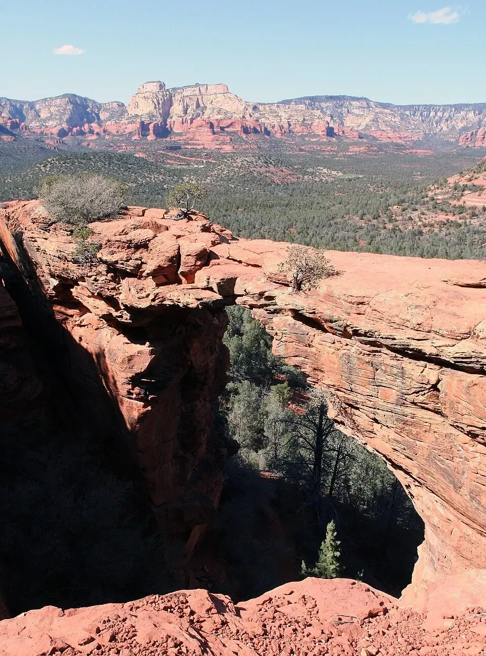
October: Devil's Bridge
This is one of the most popular hikes in Arizona, and October is the best time to do it. The weather is cool in the mornings and warm in the afternoons, which makes the exposed trail much easier to manage. The route leads to a large natural sandstone arch with open views in every direction. The full hike is about 4.2 miles round trip from the Dry Creek Vista trailhead, with a steady incline and a short rock scramble at the end. Some hikers shorten the trip by using a high-clearance vehicle to reach the closer trailhead. The arch looks dramatic at sunrise, and early starts are your best shot at beating the crowds. Bring water, wear good shoes, and expect to wait for a photo if you hike during peak hours.
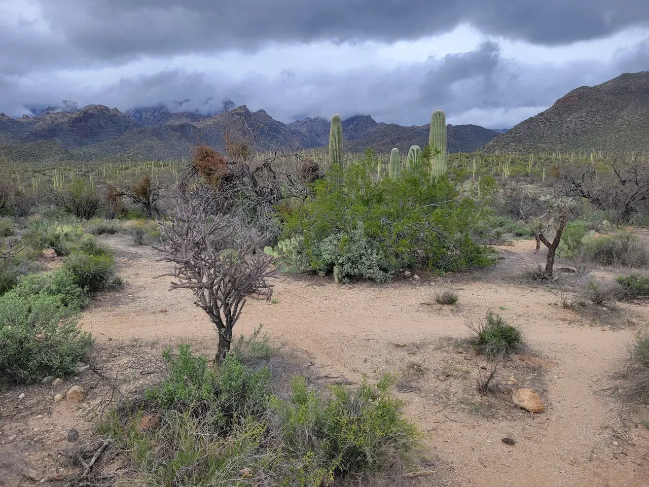
November: Chiricahua National Monument
This is one of the most underrated hiking destinations in the state. The monument is known for its tall, narrow rock formations that stack like stone towers across the landscape. The best way to see it is by hiking the Big Loop, a combination of trails that takes you through Echo Canyon, the Heart of Rocks, and back along the Rhyolite Canyon. It covers about eight miles with moderate elevation change and constant scenery. November is perfect. The weather is cool, the skies are clear, and you can spend the whole day exploring without overheating. The trails are well-maintained, and most visitors are quiet photographers and hikers, not crowds. If you’ve never been, it feels like another planet.
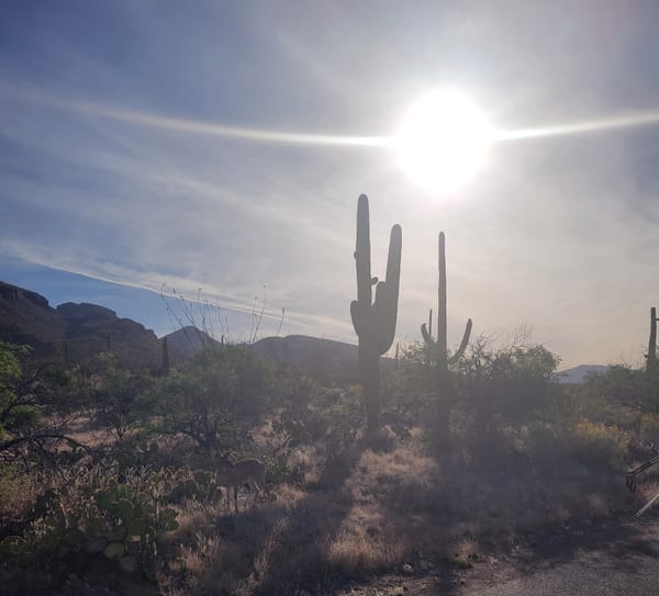
December: Organ Pipe Cactus National Monument
This remote park along the U.S.–Mexico border protects the only place in the country where organ pipe cactus grow in the wild. The desert here is harsh in summer, but in December the weather is just about perfect. Temperatures stay cool, the sun is low, and the trails are wide open. The best day hike is the Bull Pasture and Estes Canyon Loop, about four miles with great views into Mexico and deep into the Ajo Mountains. You’ll pass massive saguaros, organ pipes, and volcanic rock formations. The monument is isolated, so come prepared with water, fuel, and food. It’s one of the quietest and most unique places to hike in Arizona.
One Great Arizona Hike for Every Month
This is not a list of every great trail in the state. It is a starting point. If you want to explore Arizona throughout the year, these hikes line up with the seasons and give you a good idea of where to go and when. Always check trail conditions, permits, and weather before heading out. If you find a trail that beats the one listed here, even better. Arizona has more hiking miles than you could ever cover in one lifetime. Just pick a spot and go.